In today’s digital era, the demand for precision, efficiency, and real-time data has revolutionized the way infrastructure projects are planned, executed, and monitored. Among the most transformative technologies in this space is drone 3D modeling, which has redefined how professionals visualize, analyze, and interact with the physical world. By combining high-resolution aerial imagery with advanced software, drone-based modeling provides accurate and dynamic digital representations of construction sites, terrains, and structures.
Equally important is the integration of drone automation software, which simplifies complex flight operations, enhances data collection, and accelerates workflows. Together, these technologies are making infrastructure development smarter, faster, and more sustainable.
What is Drone 3D Modeling?
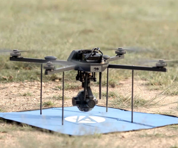
Drone 3D modeling is the process of using unmanned aerial vehicles (UAVs) to capture aerial imagery and convert it into three-dimensional digital models. Through a technique called photogrammetry, hundreds or thousands of overlapping images are stitched together and georeferenced, producing accurate 3D reconstructions of landscapes, buildings, and other structures.
These models allow engineers, architects, and project managers to:
Conduct topographical analysis
Monitor construction progress
Estimate volumes and surface areas
Plan site logistics
Simulate project designs in real-world environments
Drone-generated 3D models not only offer superior detail compared to traditional surveying but also enable interactive data exploration that improves decision-making across all stages of infrastructure development.
How Drone 3D Modeling Supports Infrastructure Projects
The utility of drone 3D modeling spans a variety of infrastructure sectors—from highways and railways to smart cities, bridges, tunnels, dams, and power stations. Below are several impactful applications:
Pre-Construction Planning
Before breaking ground, planners need accurate terrain data to assess feasibility and align design with site conditions. Drone-generated 3D models help identify elevation changes, drainage paths, and potential hazards, enabling better alignment and cost estimation.
Earthworks and Cut-Fill Calculations
In road and foundation projects, earth movement must be calculated precisely. Drone models offer volumetric analysis that helps contractors calculate cut-and-fill volumes, track material usage, and reduce over-excavation.
Progress Monitoring and Documentation
Routine drone flights can update 3D models as the project evolves. These time-lapse models help managers visualize changes, compare actual progress with planned schedules, and maintain transparent records for stakeholders.
Asset Inspection and Maintenance
Post-construction, drone models provide a digital twin of the infrastructure. These models are invaluable for detecting surface defects, structural deformations, or vegetation encroachment in bridges, highways, and other public assets.
Environmental and Regulatory Compliance
Drone-based models can help assess the environmental impact of construction, monitor vegetation or wetland boundaries, and ensure compliance with zoning laws and environmental regulations.
Benefits of Using Drone 3D Modeling
The advantages of drone 3D modeling in infrastructure projects are manifold:
High Accuracy: Modern drones equipped with RTK/PPK GNSS receivers offer centimeter-level positional accuracy.
Speed: Large sites can be surveyed and modeled in hours instead of days or weeks.
Cost-Efficiency: Reduces manpower and expensive equipment needed for manual surveying.
Safety: Drones eliminate the need for personnel to access hazardous or inaccessible locations.
Real-Time Data: With the help of connected software, data can be processed and shared almost instantly.
Stakeholder Communication: Interactive 3D models help non-technical stakeholders understand complex engineering concepts.
Role of Drone Automation Software
While drone 3D modeling offers the visual intelligence needed for better planning and execution, it is drone automation software that powers and optimizes these data collection workflows.
This software automates critical tasks such as:
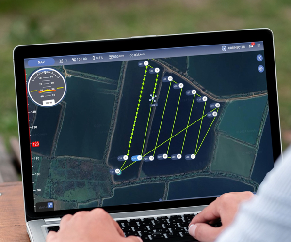
Flight Planning: Automatically designing efficient flight paths for complete site coverage
Autonomous Flights: Enabling hands-free operations for repeatable and consistent data capture
Data Upload and Processing: Seamlessly uploading aerial imagery to cloud platforms for 3D model generation
Real-Time Monitoring: Allowing live monitoring of drone positions and mission status
Integration with BIM/GIS: Exporting models to Building Information Modeling or Geographic Information System platforms
In essence, drone automation software bridges the gap between field data capture and office-based analysis, reducing human error, speeding up results, and increasing scalability across multiple projects.
Use Cases Across Infrastructure Sectors
Roads and Highways
Drone models are used for route planning, alignment design, and monitoring roadbed elevations. Automation software ensures data consistency across long linear assets.
Urban Development and Smart Cities
Drone-based 3D models allow urban planners to visualize buildings in context, plan utilities, and monitor construction in congested areas without disrupting traffic.
Bridges and Tunnels
Surveying hard-to-reach structural elements is made safer and more accurate with drones. Automation ensures precise flights around complex geometries.
Renewable Energy Projects
Wind and solar installations benefit from terrain modeling for layout optimization. Drone automation simplifies repeat surveys for progress monitoring and maintenance.
Airports and Railways
Drone 3D modeling helps in aligning tracks, runways, and platforms with minimal disruption. Automation streamlines repeat inspections and runway condition assessments.
Challenges and Considerations
Despite the benefits, some considerations must be addressed when implementing drone 3D modeling and automation:
Regulatory Compliance: Adhering to local drone flight laws and no-fly zones
Weather Dependencies: Drones require clear skies and stable conditions for accurate imaging
Data Management: High-resolution imagery and 3D models consume significant storage and bandwidth
Training and Expertise: Operators must be trained in both UAV piloting and data interpretation
System Integration: Ensuring seamless integration with existing GIS, CAD, and project management tools
By partnering with a trusted drone technology provider, these challenges can be effectively mitigated.
The Future: AI and Machine Learning in Drone Modeling
The next frontier in drone 3D modeling is the incorporation of AI-powered analytics. Drones can be trained to detect structural anomalies, classify land use, and predict erosion or displacement—entirely autonomously. Coupled with drone automation software, AI enables real-time insights and predictive maintenance that drastically reduce downtime and increase project sustainability.
Conclusion
From flight to finish, the integration of drone 3D modeling and drone automation software is reshaping how infrastructure projects are imagined and executed. These tools offer a unique blend of speed, precision, and insight that not only reduces costs but also enhances safety, transparency, and quality.
Asteria Aerospace, a leader in drone technology and intelligent software solutions, stands at the forefront of this transformation. With cutting-edge UAV platforms and automation tools designed for mapping, modeling, and monitoring, Asteria empowers engineers, planners, and developers to unlock new levels of efficiency and precision. Whether you’re building roads, designing urban landscapes, or managing national infrastructure assets, Asteria Aerospace delivers the tools to build smarter, starting from the sky.